Click on the photo to see a larger view.
Jemseg Area
Length: About 60 km of driving (one way), if side trips are taken. Gas stations are only available in Fredericton, and near Jemseg.
Directions:
From the Princess Margaret Bridge and Route 105 on the Northside of the St. John (Wolastoq) River, travel south (east) down the River towards Maugerville, then to the Burton Bridge. The area changes from suburban lots to farms and flooded fields and most of the birding begins from the farm-fields onwards. The distance from Fredericton is about 15km to the Burton Bridge, and another 13 km to McGowans Corner. At McGowans Corner, one can continue on Rte 105, or turn left on Rte 690 towards Lakeville Corner. The Lakeville Corner section goes through the floodplain forest of the Portobello National Wildlife Area and one can turn around after crossing the bridge at Lakeville Corner and return back to Rte 105. Continue downriver on Rte 105 for 11km and go under the Trans Canada (Hwy1) bridge but stay to the right along the river road. This road goes for about 6km and ends at a blocked bridge; just before the ramp on the right is a gravel road under the bridge that provides good access for a short (<1km return) walk near the floodplain forest.
Return back to the Trans-Canada Highway entrance and head east on the Trans Canada towards Moncton. There is a great view of the Grand Lake Meadows to the left but the highway is busy and its best not to stop. After a few km, take the Rte 695 exit at Jemseg, turning right at Rtes 695 and 715 into the village of Jemseg, then continue 6km towards Lower Jemseg. At Lower Jemseg (mainly 1 store and an intersection), turn right onto the Jemseg Ferry Rd and continue 3.5km to where it ends at the St. John (Wolastoq) River. If the free ferry is operating, one can cross with your car and visit the Village of Gagetown, well known for its craft shops. There also is a water treatment plant near the ferry crossing; turn right 100m after the ferry landing and the plant is obvious. There is a nice marsh area surrounding the site, which is good for wetland bird species.
The return is back the way you came, or through Gagetown and onto the roads leading back to Fredericton.
Difficulty rating: Easy.
This outing is mainly a driving trip, with periodic pull-overs to the side of the road, and birding from near the car. There is an opportunity to walk for <1 km under the old bridge near Jemseg, but this road is mud and asphalt. Be sure to exercise caution when birding and pull over well off the road because traffic can be fast and frequent at times.
Habitat:
The entire area is floodplain meadows, wetlands, and forest. Most of the area is private land and so please stay on the roads, unless given permission. The St. John (Wolastoq) River is > 200m wide and fast flowing. The River floods most springs and sometimes the flooding is enough to close roads to traffic. The roads are raised but the land on either side floods, then dries into the early summer. Remnant patches of original floodplain forest (mainly silver maple, red maple, ash) exist along the road, especially along brooks entering the River, and in a thin line along the banks of the River. The largest areas of floodplain forest are at Portobello National Wildlife Area and the area under the bridge near Jemseg.
Birding: If birding during spring, a scope is very useful for this trip because most of the waterfowl will be >100m away on the flooded fields, and on the River. This drive is popular in spring for waterfowl, where hundreds and hundreds of 21 species are regularly seen. In winter, the fields above the Trans Canada Highway can be good for rough-legged hawk and snow buntings.
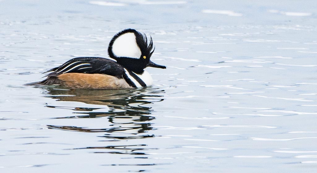
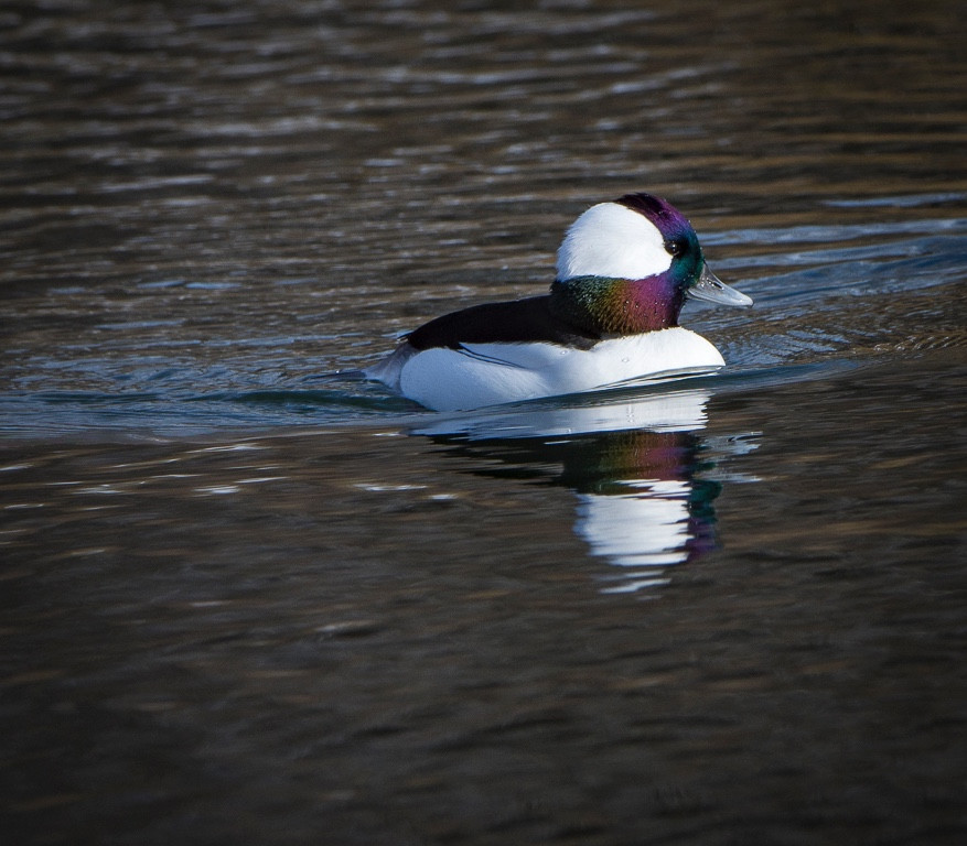
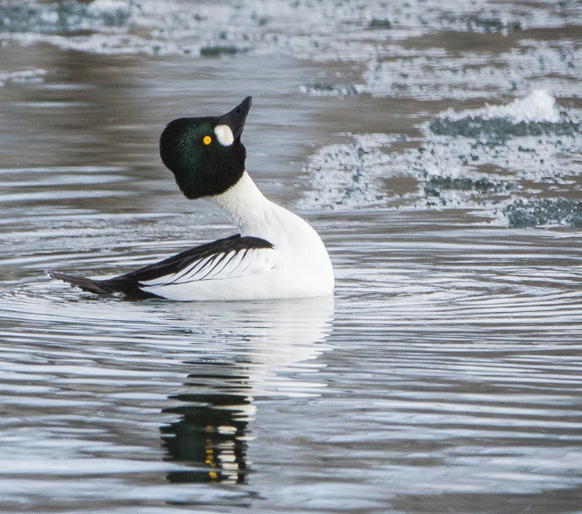
In spring, the birding is essentially different on either side of the road. The River has scattered pockets of ducks close and further from shore, and larger rafts of ducks, such as White-winged scoter, in the middle of the River. In early spring, residents and migrants are both on the River, then paired birds become more common, the rafts are gone, and eventually, only groups of males are evident because females are near the nest. The ducks arrive as ice leaves the River, which varies year by year; however, best birding is around the end of April too early May. The most common species along the River are Common goldeneye, Bufflehead, Greater scaup, Lesser scaup, Wood ducks, Hooded mergansers, and Black ducks. A few Barrows goldeneye can be found among the Common goldeneye in early spring. The Wood duck, Common goldeneye, and Hooded merganser nest in the nest boxes along the River bank.
The flooded fields have most of the above species, but are dominated by dabbler species, with American wigeon, Blue-winged teal, ring-necked, Northern pintail, Northern shoveler in close proximity. Flocks of shorebirds are not typical but Least sandpiper and Semipalmated sandpiper are possible. Black tern are most likely to be seen at the ferry crossing area.
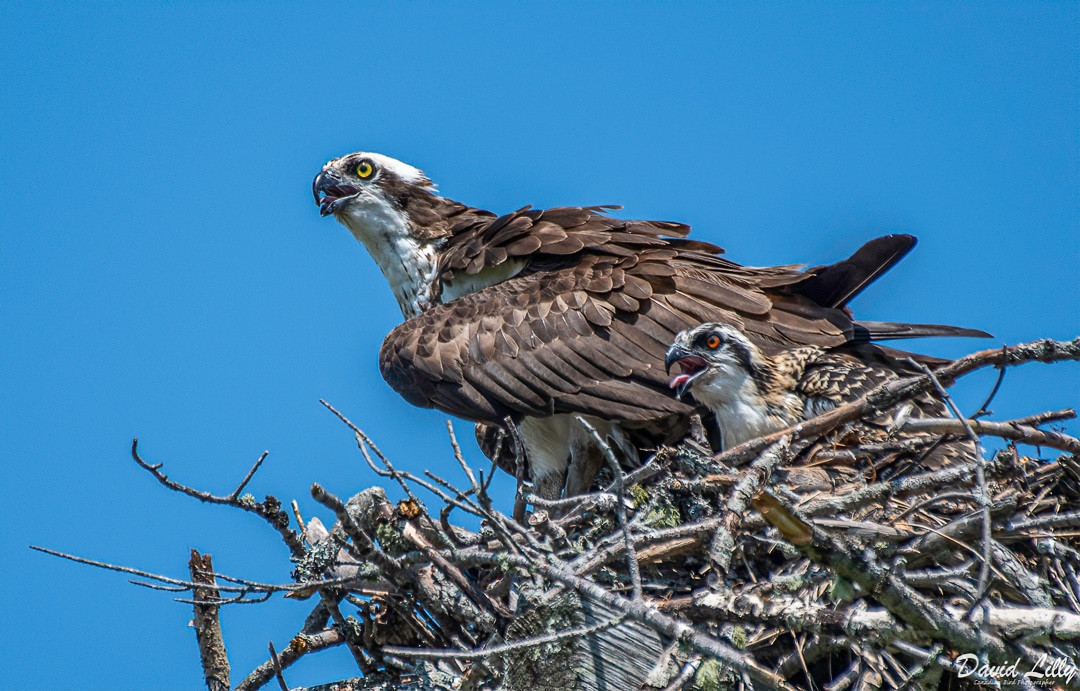
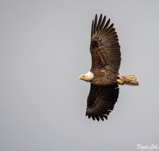
Several Bald eagles can be expected to be seen perched along the River bank trees. Numerous Osprey platforms are often active, some of which, such as those towards the Gagetown ferry, are close to the road and offer a good view. Check platforms for nesting Great-horned owl. The passerine species of note are Wilson’s warbler and Savannah sparrows in the meadow scrub; Warbling vireo and Great crested flycatcher nest in the trees along the brooks. Northern oriole can be found near the farm properties. The wettest sites have Swamp sparrow, Snipe, American bittern, Sora and Vrginia rails.
The Jemseg meadows have also produced less common species for the region, including Glossy ibis, Ruff, Pectoral sandpiper, Snow goose, Eurasian widgeon, and Ipswich sparrow.
Bald Eagle
Photo by David Lilly
Osprey
Photo by David Lilly
Common Goldeneye
Photo by David Lilly
Mallard Duck with young.
Photo by David Lilly
Bufflehead
Photo by David Lilly
Hooded Merganser
Photo by David Lilly